Showing posts with label walking. Show all posts

Sunday, 30 December 2018

Islay: walking to Solam and seeing an Eagle

One of the outdoor highlights of my year was a walk I did on Islay back in May with my son/long distance walking companion Billy. We have previously walked up to the island's highest point (Beinn Bheigier), as well as walking to the highest point on England’s south coast (Golden Cap in in West Dorset) among other places.

But our most difficult walk so far was in search of Solam, an abandoned settlement in the hills north of  Ardbeg. It is a walk I have done a number of times and have always found both frustrating and rewarding. I’ve never managed to locate the same places each time and I’ve always got lost at some point.

My first visit was way back in 1984 when my dad, who came  from that part of Islay, led my family over the hills from Callumkill – the farm where my grandparents lived and worked. My memory of that visit is trekking through boggy ground on a hot summer’s day while my dad kept promising “It must be over that next hill”. What we did find eventually, concealed in a hillside, was Tobar  na Dabhaich (well of the hollow). Also known as Saint Michael's Well, my father told me that it was a place where people visited for good luck when they got married, and indeed there were at least two horseshoes above in the rock when we found it, one old and rusted and one seemingly fairly recent with ribbon attached. I believe there were also coins in the water. The well also seems to have been the water supply for a nearby settlement reputed in Islay folklore to have been an abandoned plague village. Some trace of its buildings can apparently be seen near the well... if you can find it.

Me and my sister at the well in 1984 - you can just about make out horseshoes in rock above

In 2005 I tried to find the well again with 'clear' directions from my uncle who lives nearby. Not wanting to repeat my dad’s experience of searching in the company of increasingly tired children, I thought it would be best if I went exploring on my own first. The idea was that having found the well and remembered the route I would then return with the rest of the family later on – it would be so easy! I had the ordinance survey map for the area in my back pocket but unbeknownst to me it fell out as I was climbing over the first gate. The weather turned from sunny to cloudy and I found myself lost in bracken that was as tall as me. I had no map and no phone signal, I failed to find the well or any ruins but I did end up at a lonely Loch Larnan with just me and a couple of swans. The Loch feeds Ardbeg distillery with fresh water via the Ardbeg Burn, a stream which you will need to cross to get to Solam - there is a bridge but if you can't even find that you may not get far. When I stumbled across a dead cow lying across the path I took it as a sign to return home

This year with Billy I had the advantage of GPS with the OS map on my phone. The first part is easy enough anyway - you start at the crossroads where the road into Ardbeg diverges from the main road (you can park car/bike in distillery car park). On the north east corner of this there is a single house with a track to its right which you follow for as far as it goes.


After a field, the track turns left, and ends up at the bottom of a hill with a ruin on top of it You can either follow the track round to the left to skirt the hill or climb over it via the ruin.
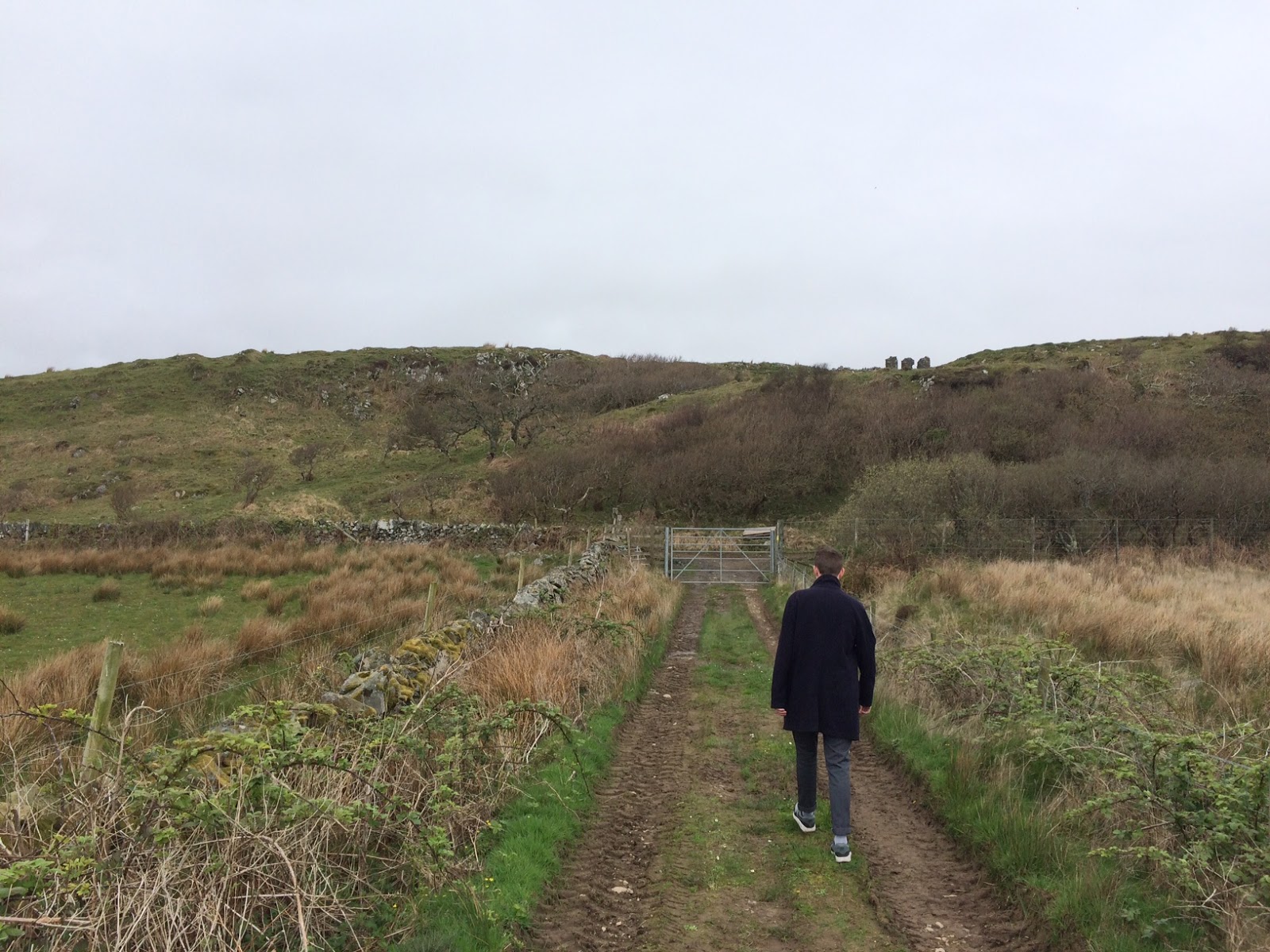


We did the latter. This is marked on the map as 'Airigh Nam Beist' (Shelter of the beast) - the name given to a popular bottling of Ardbeg whisky.


From the bottom of this hill you head across to the bridge across the Ardbeg Burn. After this things got very muddy and we soon got lost. The phone ran out of power eventually and of course in the hills the signal was patchy. The Strava map for this part of our walk before the phone gave out shows that we were walking round in circles some of the time. The low ground there is very marshy, it’s difficult – probably impossible – to avoid getting your feet wet. Once again I failed to find the well!

What we did stumble across was remarkable though. Between us we saw three Adders, recognisable by the zigzag pattern on their backs. That was slightly alarming as you would clearly be in trouble up in the hills with a poisonous snake bite. But as we were scouring the hills for the well a Golden Eagle flew out a few metres in front of us. I believe it was nesting in the rocks, we could hear the young ones in the nest. I’ve only ever seen a (presumed) eagle in the distance before, up close there is nothing like it with its a huge wingspan.


We ended up at the ruin of a house at Solam. This is not one of the supposed 'plague village' remains near the well, but there is a sign here telling its story.


The sign telling the story of the 'plague village' - the legend is that the villagers became infected as a result of a gift of a mother of pearl necklace from a shipwrecked sailor. Food was left out for the quarantined villagers until they all died (see here for more discussion about this story - there may be truth in it but very unlikely that this happened in 18th century.

The way back was not so bad. The ruined house is next to the boundary wall for the Callumkill estate, you can see the building marked on the map next to the letter 'm' in Solam on OS Map (extract below). From there there is a fairly direct path back though not as easy as it looks on map - we got our feet wet again but were passed caring by then.

Sometimes the best journeys are those which don’t reach their intended destination but which find something unexpected along the way. I can't leave detailed instructions for this walk. My various misadventures have made me wonder if we are really meant to find everything there- out in the lonely country it’s not hard to believe in fairies or other mysteries! So do go and explore but take care... and maybe wear wellies.


See also-


Islay running posts:

Tuesday, 11 July 2017

The Outrun - Amy Liptrot


Amy Liptrot's The Outrun (2015) is partly another fine example of the new nature writing - urban dweller rediscovers connection with the wild between nicely illustrated covers, in this case through returning to her native Orkney where, among other things, she helps her farmer father in the lambing season and gets a job tracking corncrakes. The Outrun of the title 'is a stretch of coastland at the top of the farm where the grass is always short, pummelled by wind and sea spray year-round... where the ewes and the lambs graze in summer'. That aspect has a not entirely unromantic appeal to me, with my fond memories of my shepherd grandfather in the Hebrides.

But the book is also a memoir of addiction, to alcohol in particular, and the author's struggle to recover after some very messy years in London. Her relationship with the landscape is part of this process. Struggling to believe in 'a power greater than ourselves' as envisaged in the Alcoholics Anonymous 12 step programme, she thinks 'about the forces that I have experienced living on the islands: The wind and the sea. I think of erosion and corrosion… I think of the power of animal instinct, guiding the corncrakes to Africa and me to my lover's house, dead drunk, late at night… I decide that I can accept the existence of some "powers greater than myself" – not God, just the things I've always known, the forces I've grown up with, strong enough to smash up ships and carve islands'.

She walks all over Papay, one of the smaller islands where she lives for a while, including circumnavigating St Tredwell's Loch where once pilgrims seeking relief for eye troubles came to visit the chapel dedicated to a saint who legend claims gouged her own eyes out.

She joins the Orkney Polar Bears who go swimming every Saturday morning in the sea and manages to find through this the beginnings of new compulsions: 'Once after being out all night at a party in a squatted East London warehouse, Gloria and I decided, high and wide eyed, that what we needed was a dawn swim in Hampstead Heath ladies pond. We had grimy rave skin and sleep deprivation and thought the cold water would provide refreshment and even salvation... In the past when I was under stress, my first impulse was to drink… Now, sometimes, I'm not just fighting against these urges but have developed new ones. Even back in the summer, set free after a frustrating day in the RSPB office, my first thought was sometimes not a pint but "get in the sea". Swimming shakes out my tension and provides refreshment and change... The motivation is the same but my methods of dealing with the way I feel are changing. I used to confuse my neurotransmitters on a Friday night in a hot nightclub. Now I shock my senses on a Saturday morning in the biting sea, plunging warm skin into cold water, forcing a rush of sensation, cleansed'.

Interesting how culturally embedded this idea of water as medium of baptism and rebirth is, to swim in the sea or even the Hampstead ponds is to literally plunge into the landscape (or waterscape) and perhaps to emerge with a sense of being somehow cleansed or transformed.

The Outrun is certainly not another rehab through fitness memoir, but the author recognises that part of her recovery is also about a new relationship to her body in movement, including through walking, swimming and scuba diving: 'When I am in motion I am at ease, able to move forward mentally as well as physically. I use walking and swimming to calm my churning thoughts. My sea swims are increasingly important in relieving the non-specific low-level anxiety I often feel. The cold water shocks out any mental stress – my body suddenly has something more immediate to deal with'.

Sunday, 23 October 2016

Walking Beinn Bheigier: Islay's highest point

Beinn Bheigier (pronounced Ben Vicar) is the highest hill on the Isle of Islay. With a height of 491m it falls short of the 600m that would make it a mountain (at least by the official UK government definition), but it is a fair height and its summit is suitably remote.

Our starting point was at the pebbley Claggan Bay, reached by following the single lane road that heads north east up country beyond Ardbeg until the road almost runs out. Just past the little road bridge that crosses the Claiggan river, there is a track on the left heading up towards Beinn Bheigier.


The Claiggan from the road bridge

The track heads from Claggan Bay - through the gate and straight on


You can follow this vehicle track as it loops around, first to the left, then to the right, going through a deer gate until it stops. Or you can take a bit of short cut across the loop - shortly after the track turns to the left, there is a gate on the other side of a ditch after which if you head north west will bring you at the same place - the deer gate in the fence before the last section of vehicle track (we went up this way, and came back on the longer but easier full track loop)


take this gate for the short cut across the vehicle track loop
The lower slope of the hill is hard work, with tussocky grass and lots of heather. You never quite know whether you are stepping on firm ground or into a bog. 


You will hopefully find a path to follow, a faintly visible track of trampled dry heather, but if not the thing to remember is that you are heading to the south east shoulder of the hill (i.e the left hand side as you going towards it).


There is a cairn at the top of this slope but that's not the top. From here there is a stony ridge and a mostly more gentle slope which heads north west for about a mile upwards to the summit.


There is a trig point at the highest point surrounded by a dry stone wall for shelter on what can be a windy exposed spot with good views across the sea to Ireland and the Mull of Kintyre.

There is an account of 'dubious veracity' of a battle between MacLeans and McDonalds at Beinn Bheigier in the late 16th/early 17th century, described by Islay historian David Caldwell as 'an unlikely place for a battle' ('Islay: the Land of the Lordship', 2008, p.93). It certainly would have been hard work fighting up here, but it's just possible I suppose that there could have been a look out point worth fighting over.


The area is used for deer stalking, and a sign back in Claggan Bay gives advice on this - essentially walkers are welcome, but look where you're going in the main stag stalking season (mid-August to mid-October). Seeing deer up on the hill, including right at the top, is one of the highlights of the walk. Of course we have plenty of deer in some London and SE England parks - stags were bellowing as we ran in the Surrey League cross country in Richmond only last week - but you don't see them in full motion in quite the same way. At the top of Beinn Bheigier we watched a young deer charge off down a steep slope like it was almost flying, It put me in mind of Nan Shepherd's observation in her great book on the Cairngorms, 'The Living Mountain': 'Bird, animal and reptile - there is something of them all in the deer. Its flight is fluid as a bird's... They seem to float; yet their motion is in a way more wonderful even than flight, for each of these gleaming hooves does touch the ground'.


As always hill walking in such areas, be prepared for changes in the weather. You can start off in bright sunshine at the bottom, and find yourself cold and lost in the clouds on the top.

it was windy up there!
The walk was just over seven miles there and back, taking us three hours. My strava route is here, I found the Walk Highlands reports useful in planning the walk - you can download a GPX file to help.


See also-


Islay running posts:
 

Friday, 2 September 2016

Wilfredo Prieto - Walk (2000)

Cuban-born artist Wilfredo Prieto made 'Walk' (2000) during a residency on the Caribbean island of Curaçao. The artist put a plant in a wheelbarrow filled with soil and took it on a five-kilometer walking tour. According to the programme, 'While there is a comic absurdity to this gesture, Prieto’s work connects to a long tradition of walking in twentieth-century art, its precursors including the Situationists’ dérive (drift), the Surrealists’ unconscious explorations of Paris, Robert Smithson’s forays into the ruins of Passaic, New Jersey, and Francis Alÿs’s treks around Mexico City'.


The work is included in 'Under the Same Sun: Art from Latin America Today' at South London Gallery until September 11th. Lots of other interesting work in the exhibition too.


Saturday, 16 July 2016

'These forms who hasten by' - ghosts and runners on the Pilgrims Way (1923)

The Pilgrims Way

Along the Pilgrims' way.
The yew trees sigh and sway,
They stand a lasting line,
On ancient days a sign.

The monk and minstrel gay
With prayer and roundelay;
The pedlar with his load;
They took the Pilgrims' road

And when the sun is low,
They sometimes seem to go
Along the same old track,
By yew trees, gnarled and black.

When folks say what they've seen,
Well, WE know what they mean;
These forms who hasten by,
Are really you and I!

(RMH, South London Harriers Gazette, November 1923)


Pilgrims Way,  Kent, 1950 - Bill Brandt
The Pilgrims Way is a route between Winchester and Canterbury, at least part of which follows ancient trackways on the North Downs even if its name and conception as a single continuous route probably goes back no further than the 1870s. It is popular with walkers and runners - including those taking part in  The Pilgrims Challenge 66 mile ultra marathon in the last couple of years.

The notion of following in the footsteps of ancient pilgrims is an evocative one, and in a certain light quite haunting. In the 1920s, when this poem was written, there was upsurge of interest in both the great outdoors and in ghosts. Robert Macfarlane notes that in this period 'people, traumatized by the war, took to the paths in search of ghosts  - setting out on the tracks of the lost and left-behind. Old paths became mediums in two senses: means of communion as well as means of motion. The convivial pilgrimages described by Chaucer became tinged with a morbid historicism: spectres stepped from the verge or hedge, offering brief address' (The Old Ways: a journey on foot, 2012).

This would seem to apply to this poem, which I found in an old South London Harriers newsletter, but  I like the twist  - that what others see as ghosts may in fact be runners hastening by.

I wonder who 'RMH' was?

[update - South London Harriers have identified an R.M. Harrison who ran for the club in this period, so he is possibly the poet]

Hamish Fulton's The Pilgrims Way features in the current 'Conceptual Art in Britain' exhibition at Tate Britain gallery in London. In  April 1971, Fulton conceived of  'A 165 mile walk' on 'Ancient paths forming a route between Winchester and Canterbury' as an art work leaving no trace other than this photograph of  'A hollow lane on the North Downs'.


More running related literature: